
 Residents across much of central Indiana should prepare for the potential of severe weather today as forecasters warn of multiple rounds of thunderstorms capable of producing damaging winds, large hail, tornadoes, and heavy rainfall.
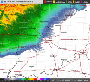
According to the National Weather Service in Indianapolis, the first round of thunderstorms is expected to develop this afternoon, primarily affecting the northern two-thirds of the state. A second and potentially more significant round of storms is forecast to arrive later this afternoon and continue into the evening across much of central Indiana.
Meteorologists say severe weather is likely with the evening storm system, bringing the risk of damaging straight-line winds, large hail, isolated tornadoes, and periods of heavy rain that could lead to localized flooding.
In addition to thunderstorm activity, strong winds outside of storms are expected throughout the day, with gusts reaching up to 40 mph during the afternoon and evening hours.
Counties included in the weather outlook include Carroll, Warren, Tippecanoe, Clinton, Howard, Fountain, Montgomery, Boone, Tipton, and Hamilton counties, along with many other locations throughout central Indiana.
Emergency management officials encourage residents to monitor weather forecasts throughout the day and ensure they have multiple ways to receive weather warnings, especially during the evening hours when severe storms are expected to be most widespread.
The National Weather Service also indicated that spotter activation is likely this afternoon and evening as severe weather develops across the region.
Looking ahead, additional thunderstorms are possible Sunday into Monday, although details regarding the timing and severity of those storms remain uncertain.
Residents are urged to review severe weather safety plans, identify a safe shelter location, and stay alert for changing weather conditions throughout the day.